The photographic record · 3 photographs
Maps & Areas of Operation
Field maps preserving the landing zones, roads, and areas where H Troop operated.
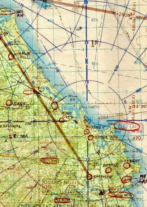
H Troop’s operating area in I Corps
An annotated field map showing some of the landing zones, bases, roads, and areas where H Troop operated in I Corps. Handwritten markings include locations such as LZ Bayonet and other positions along the Chu Lai–Quảng Ngãi area.
Map supplied to the H Troop archiveView photograph & details →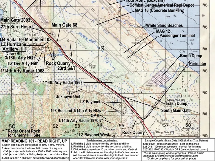
Chu Lai and LZ Bayonet reference map
A later annotated reference map placing LZ Bayonet and LZ Bayonet West southwest of the Chu Lai airfield along Highway 1. Labels also identify Americal and aviation facilities, artillery positions, gates, beaches, quarries, and support areas. The map describes itself as an ongoing work in progress assembled with contributed grid coordinates; it is presented for orientation and should not be treated as an official H Troop field map.
Historical reference map found online; original compiler and publication source not yet confirmedView photograph & details →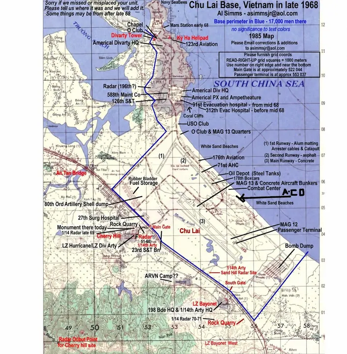
Chu Lai Base and LZ Bayonet — Late 1968
A veteran-compiled reference map depicting the larger Chu Lai base complex in late 1968. It identifies the Americal Division headquarters, airfield and aviation facilities, hospitals, beaches, gates, supply areas, artillery positions, Highway 1, LZ Bayonet, and LZ Bayonet West. Compiler Al Simms notes that the map was assembled retrospectively using a 1985 base map, that some locations may date from after 1968, and that corrections were welcomed. Presented for geographic orientation rather than as an official wartime H Troop map.
Compiled by Al Simms; shared online by William Hassle; original publication source not yet confirmedView photograph & details →