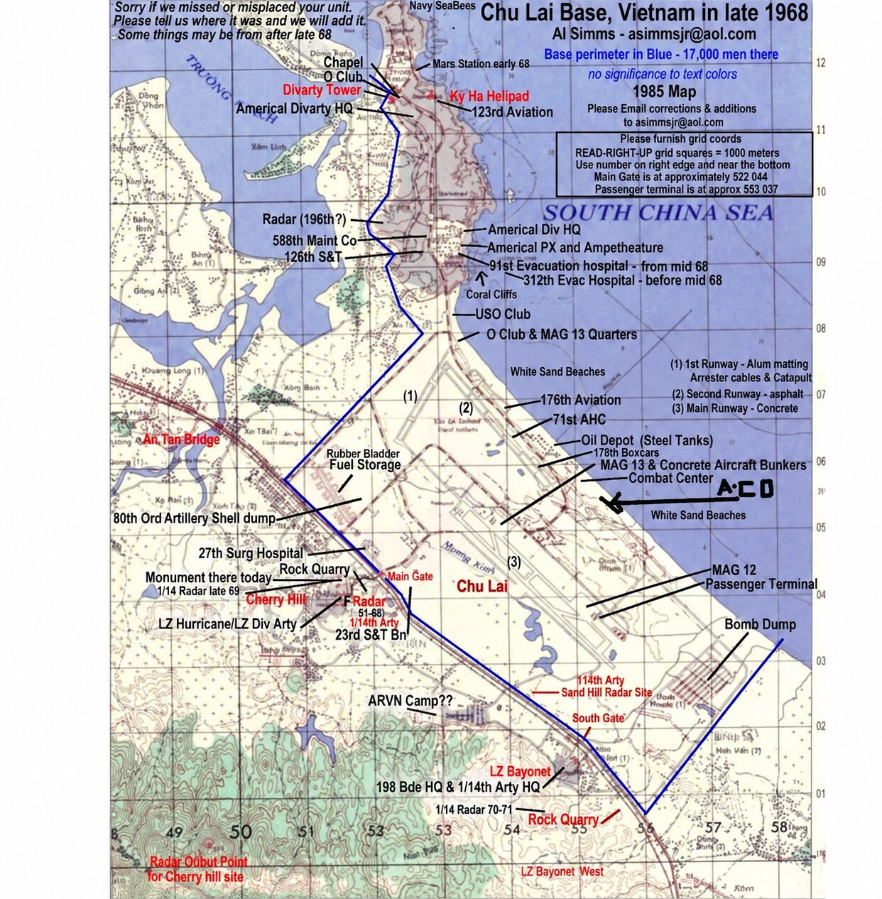
Chu Lai Base and LZ Bayonet — Late 1968
A veteran-compiled reference map depicting the larger Chu Lai base complex in late 1968. It identifies the Americal Division headquarters, airfield and aviation facilities, hospitals, beaches, gates, supply areas, artillery positions, Highway 1, LZ Bayonet, and LZ Bayonet West. Compiler Al Simms notes that the map was assembled retrospectively using a 1985 base map, that some locations may date from after 1968, and that corrections were welcomed. Presented for geographic orientation rather than as an official wartime H Troop map.
Compiled by Al Simms; shared online by William Hassle; original publication source not yet confirmedThe H Troop family remembers
Memories, Names & Places
Recognize a face, location, date, track, or moment? Add what you remember. Contributions appear here immediately; email addresses are never displayed.
Loading shared memories…