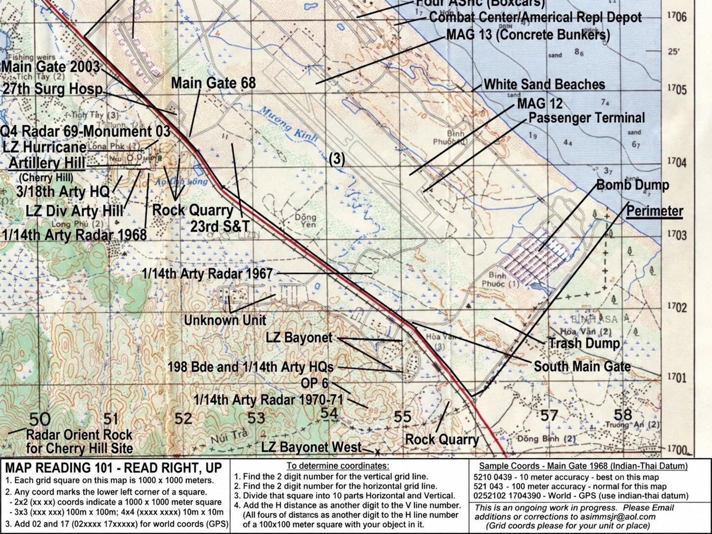
Chu Lai and LZ Bayonet reference map
A later annotated reference map placing LZ Bayonet and LZ Bayonet West southwest of the Chu Lai airfield along Highway 1. Labels also identify Americal and aviation facilities, artillery positions, gates, beaches, quarries, and support areas. The map describes itself as an ongoing work in progress assembled with contributed grid coordinates; it is presented for orientation and should not be treated as an official H Troop field map.
Historical reference map found online; original compiler and publication source not yet confirmedThe H Troop family remembers
Memories, Names & Places
Recognize a face, location, date, track, or moment? Add what you remember. Contributions appear here immediately; email addresses are never displayed.
Loading shared memories…